With great anticipation, my two friends and I awaited the results of the daily Half Dome permit lottery to find out if we would be able to summit the famous Half Dome. We were not yet in Yosemite National Park but finishing up our stay in Sequoia National Park, another revered national park a couple hours south of Yosemite Valley in the Sierra Nevada range of California. “we won!” I exclaimed when I received the congratulatory email. It was now official and we couldn’t believe that within just 48 hours, we’d have to opportunity to do a hike of a lifetime.
It’s now 2 days later and my friends and I are in our Upper Pines Yosemite campground preparing to set off to the trailhead of the John Muir trail. We hit the trail at about 8:30am and begin our approximately 18 mile round-trip journey. The first 2 miles or so of the trail are fairly paved, along with some rocks and dirt, and gravel. It became quickly apparent that we would be walking uphill for most of this journey, which makes sense considering the whole hike was about 5,000′ of elevation gain. We stop maybe once or twice for a moment, though make our first snack break at Clark Point.
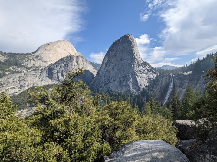
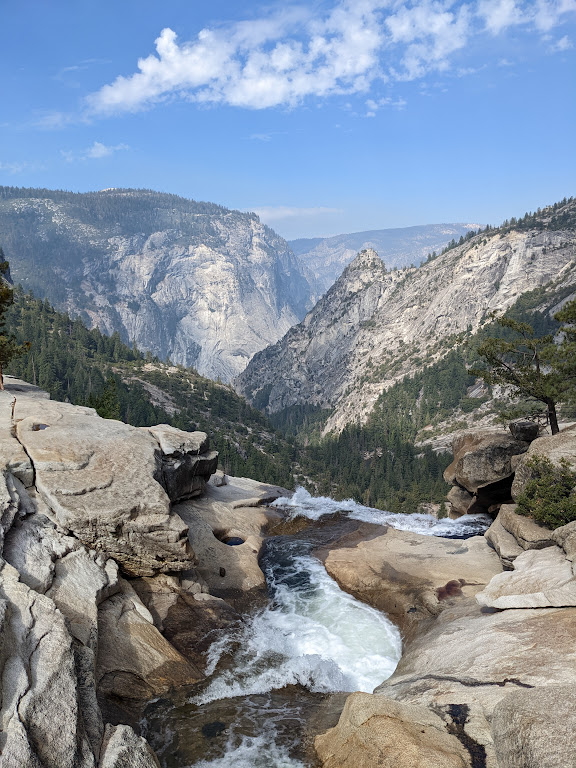
Clark Point is an unbelievable vista, with a view of Nevada Fall and Half Dome in the distance across a valley. Even though we had been on the trail for 2 hours, we were just getting started. Continuing onwards, we take the John Muir Trail another couple of miles to the top of Nevada Fall, where we stop for a trail breakfast. I was surprised that we still had cell service at this point. I had been to Yosemite once before, in 2018, and cell service was non-existent, but I suppose they’ve since brought service to the Valley to the pleasure of Instagrammers everywhere.
Continuing onwards, the trail after Nevada Fall becomes a little more level and sandy. I don’t know how much distance exactly, but soon enough we come to another difficult and rocky section of significant elevation gain. Sure enough, this elevation would continue for the rest of the hike. We press on and make it to the section just before the Subdome where we see the signs warning about the dangers of proceeding, as well as the need for permits. We decide to stop for some lunch on the trail before continuing onwards.
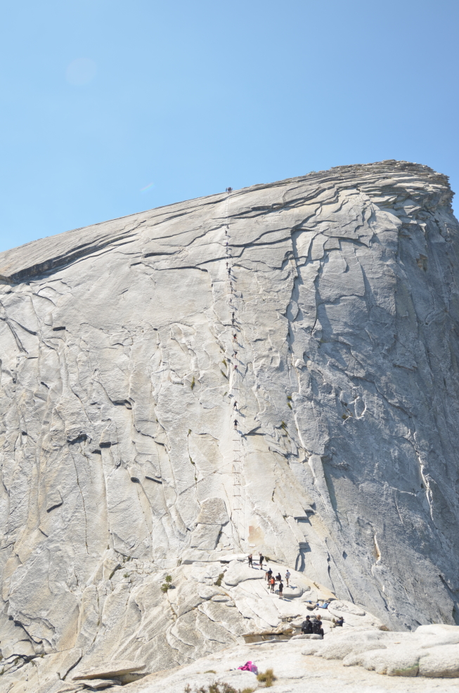
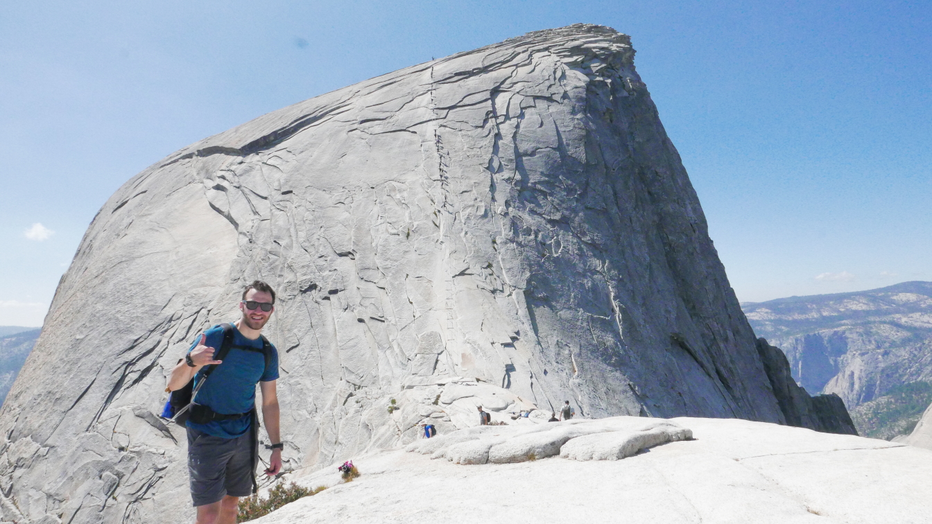
We’re now at about 7,500′ elevation, having hiked up about 3,000′. During my research, I read that ascending the Subdome is actually the hardest part of the hike, more difficult than the infamous cable climb. And we would learn that what I read was entirely true- the hike up to the Subdome is intensely steep, and supremely difficult with the thinning air at the altitude. However, with several breaks to catch our breath, we press on and reach the cables.
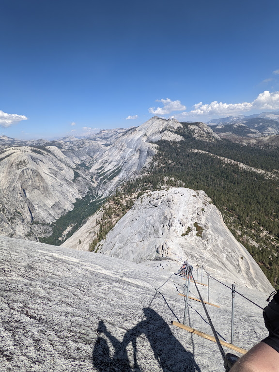
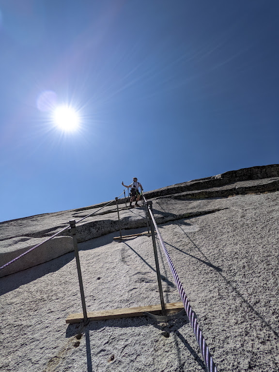
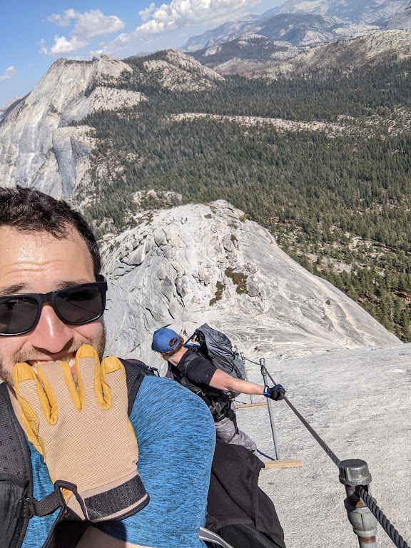
At long last, we make it to the cables after about 5 hours on the trail! I had read that the cables are much steeper than they seem in pictures, and, once again, what I had read was correct. The cables are extremely steep and the granite is slick, even when dry. My friends and I were actually some of the only people to wear harnesses while doing the cables section, and we were glad to have worn them. While it’s true that the cables can be climbed safely without a harness, and that the majority of people don’t wear one, having one definitely helped make it a more enjoyable experience and dare I say more carefree. With the harness as a backup, I felt much more relaxed on the cables, and felt like I could truly absorb, take in, and enjoy the moment. I didn’t feel like I had to hang onto the cables for literally dear life and be super attentive to each and every move. I was definitely not being reckless, but the security of the harness definitely allowed me to be freer on the cables, ironically. After about 20 minutes on the cables, we made it to the summit!
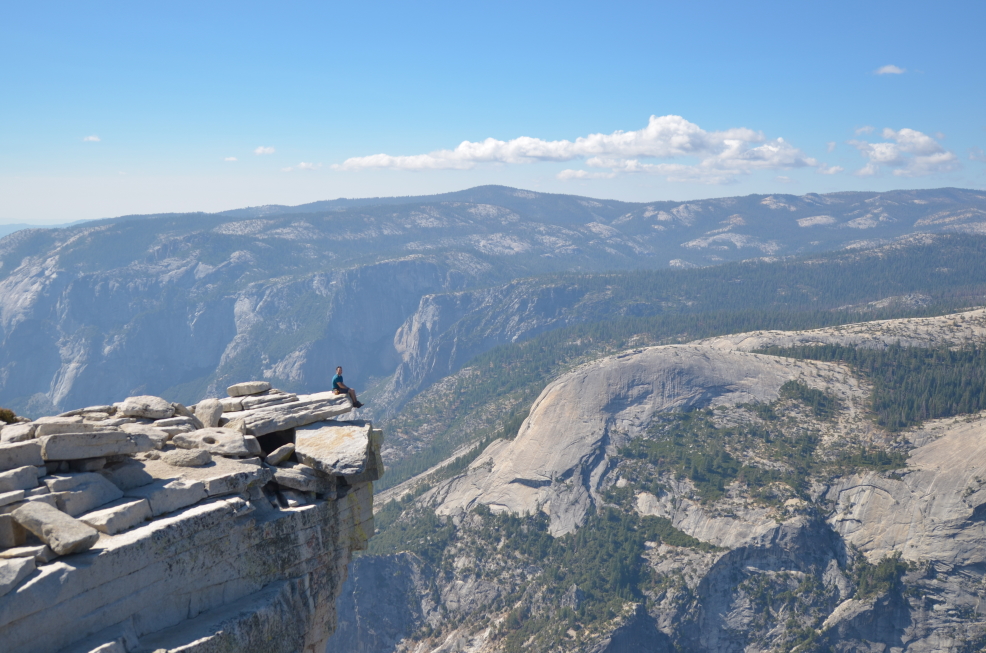
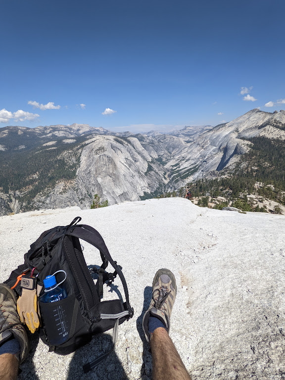
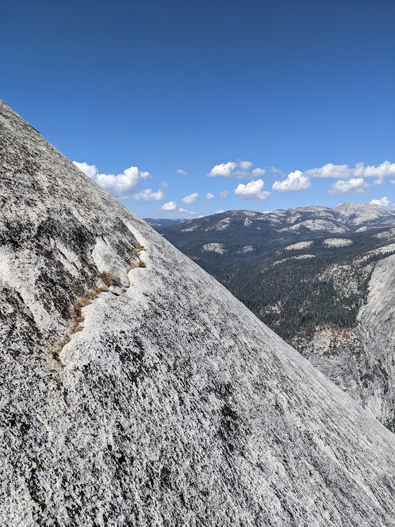
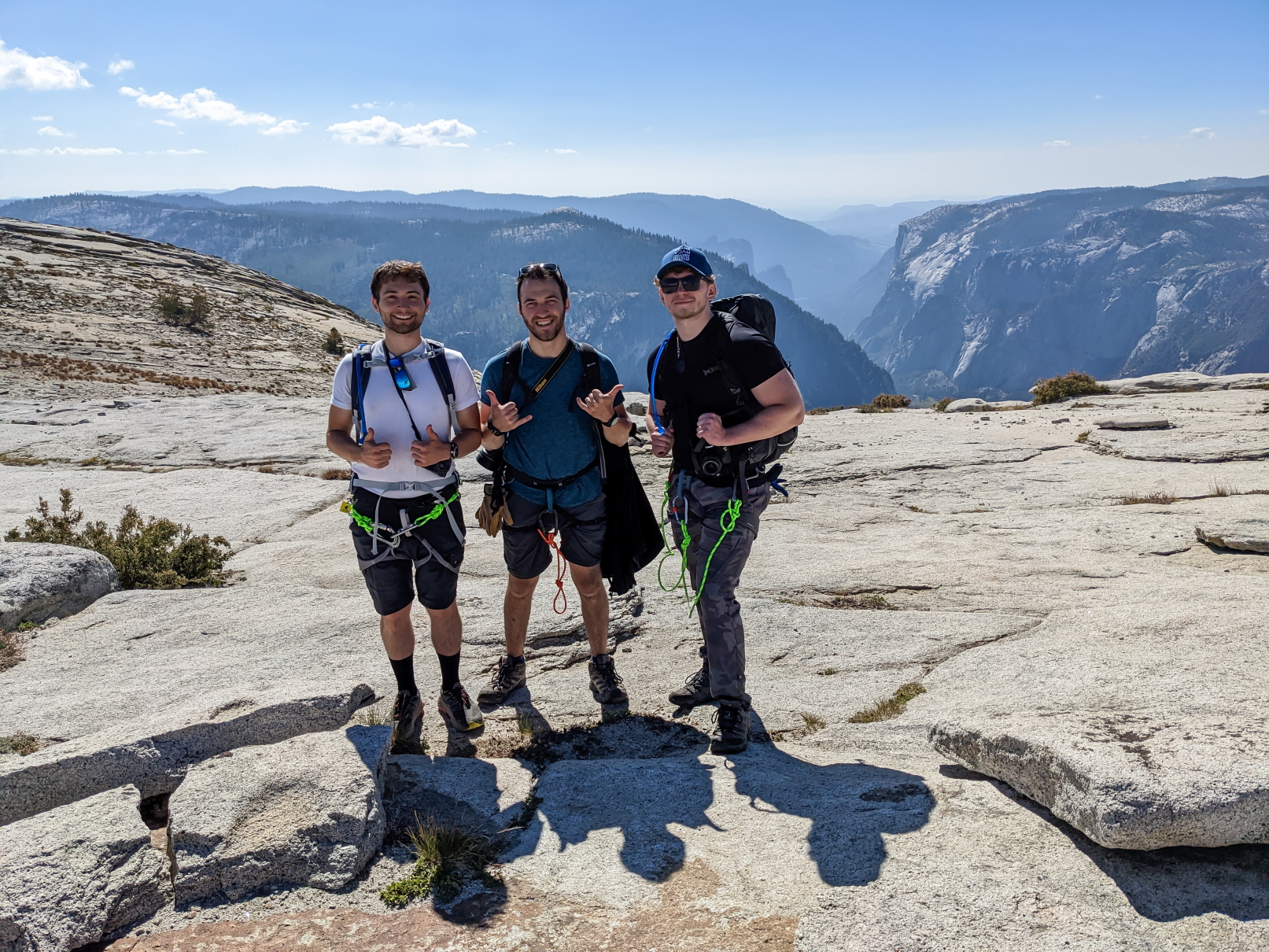
The summit of Half Dome kinda surprised me with how large and relatively flat it is. It’s a breathtaking place to be, a place that only a couple hundred people are allowed to visit a day, and a place that not everyone is in enough shape to access. It feels like being on top of the world, being up around 8,800′, surrounded by pristine and majestic granite valleys and peaks as far as the eye can see in every direction. Don’t mind the sheer 4,000′ drop off the side of the mountain to the Valley floor, it’s not every day one gets to look straight down 4,000′ and be unable to comprehend the height.
After about 90 minutes spent enjoying and exploring the summit, my friends and I have a snack and prepare for our journey back down to the Valley. It took us about 4 hours to make it back down, which was longer than I thought it would, to be honest. At the top of Nevada Fall, we decided to take the Mist Trail down, and hop back on the John Muir at Clark Point again to finish it off. We ended up finishing at about 8p, using our headlamps to guide us the last 2 miles or so as it had become dark at that point. It felt so good to make it back to the campsite and take off my boots. While the hike was without a doubt the hardest hike I had ever done, and also probably the most physically demanding thing too, it was also one of the greatest experiences of my life.
Trail Statistics
- Distance – 17.9 miles (28.8km)
- Elevation Gain – 5,837′ (1,779m)
- Total Time – 11 hours, 36 minutes, 27 seconds
- Moving Time – 8 hours, 18 minutes, 21 seconds
- Calories Burned – 4,322
- Step Count – 40,130